Walks Hawes & Wensleydale – Author: Richard Hallewell
Re walked by Richard & Maggie Legate
The guide to the walks in this beautiful Yorkshire Dale – essentially, walks in the area between Hawes in the west and Leyburn in the east – was completely rewalked in the Spring of this year. There have been relatively few changes to the routes in this area (except for the felling of the trees in Cotterdale Wood, which necessitated a change of description), so the changes to the guide are largely tweaks to route descriptions to make them more easily followed. The only serious difficulty in the rewalk was dealing with the aftermath of the dreadful winter flooding in the area.
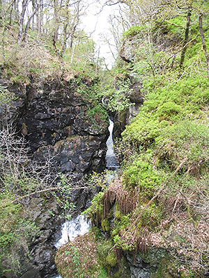
The Yorkshire Dales are so famous that it is scarcely worth mentioning that this is a superb walking area. The hills are not high, but the broad valleys, with their patchwork of walled fields dotted with stone barns, provide some wonderful routes. And, as with the Lakes, walkers will meet with some wonderful inns along the walks. Highlights include the walk north from Hawes to the fine waterfall of Hardraw Force (see bottom left), the path from Aysgarth Falls to the imposing Bolton Castle, and the gentle walk along the wooded escarpment of Leyburn Shawl.
For more details or to buy a copy click here.